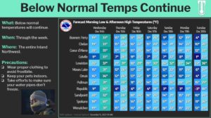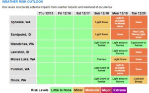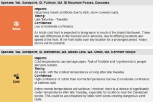

SPOKANE, WA – The National Weather Service says the Inland Northwest is in for a “prolonged snow event” likely Sunday through Tuesday, with very cold temperatures possible by midweek. Widespread snow is expected to arrive late Saturday night and remain in the region for a few days. The intrusion of very cold air could be accompanied by brisk northerly winds on Tuesday and Wednesday. If the extreme cold air moves into the Inland Northwest, the agency says it won’t last long with warmer than normal temperatures possible by the end of next week.
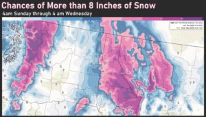
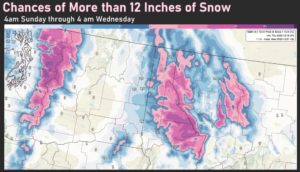
“Uncertainty remains high in regard to the forecast. Below normal temperatures likely but there is high uncertainty with snow amounts and how cold temperatures will get. The forecast is also trending toward heavier snow versus seeing extremely cold temperatures. Locations with the best chance of seeing heavy snow include the Cascade Passes, and the Idaho Panhandle,” the NWS says.