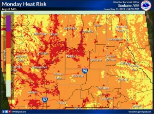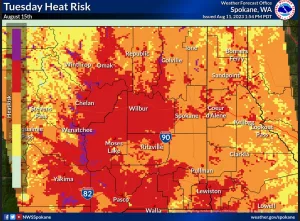
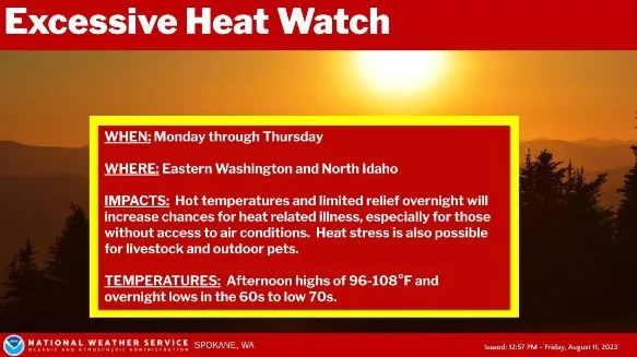
LEWISTON, ID – The National Weather Service says the hot summer temperatures will be returning early next week with the region experiencing the hottest weather between Monday and Thursday.
“A few locations will approach or exceed record highs, with some spots pushing over 100°F. The developing heat could also allow some of the wildfire activity to flare up, largely north of the border in British Columbia, allowing the potential for some smoke or at least haze to spread in from the north toward the middle to later part of next week,” NWS says.
| KEY POINTS | ||||||||||||||||||||||||||||||
|
||||||||||||||||||||||||||||||
| CHANGES FROM PREVIOUS BRIEFING | ||||||||||||||||||||||||||||||
| A heat watch has been issued for the region Monday through Thursday | ||||||||||||||||||||||||||||||
| WEATHER RISK OUTLOOK | ||||||||||||||||||||||||||||||
| Risk levels incorporate potential impacts from weather hazards and likelihood of occurrence. | ||||||||||||||||||||||||||||||
|
||||||||||||||||||||||||||||||
| DETAILS | ||||||||||||||||||||||||||||||
| FOR MORE INFORMATION | ||||||||||||||||||||||||||||||
| For the latest forecast updates, visit weather.gov/spokane. |